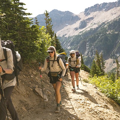
Bend is home to arguably some of the best trail runs in the world as well as the best trail runners. While the running scene in Central Oregon might often be overshadowed by its flashier and faster cousin - cycling - Bend is known nationally as a great place to train, compete or plan a vacation around exploring the trails.
Lucky for us locals, many of Bend's trails can be accessed through other trails maintained by the Bend Parks District. In many cases, we can avoid getting in the car altogether. Within a few miles of downtown, there is everything from loops that feel like mountain climbs to gentle routes along the Deschutes River that have almost no elevation gain.
One of my favorite things about running on trails is that you can see a lot of scenery in a short time, especially if you can work your way up to some longer routes. Trail running is also a lot better for your body because dirt is more forgiving than pavement, and you get to breathe fresh mountain air instead of car exhaust.
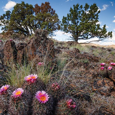
On my way home from Portland recently, I stopped off at Smith Rock State Park in search of the endless single track that I've heard goes on for miles northeast of the park. The state park map only details trails inside the park proper, and the folks in the parking lot were all serious-looking climbers or not-so-serious looking tourists, so they weren't much help. I spotted a crude road that zigzagged out of the park to the east and decided to aim for that.
My first mistake was following a trail on the wrong side of the river for a while, waiting for a magical bridge to appear that I thought I'd seen on my little map. After about a quarter of a mile following random climber's trails by the river's edge, I encountered a series of giant boulders and decided it was time to turn around. The fantastical bridge never appeared and I realized, upon further examination of my map, that it was actually a horse forge.
Back in the parking lot, I found a park ranger who told me that my intended destination, Burma Road, is the gateway to trails accessing Gray Butte. It was also the beginning of an eight-mile loop that drops behind the park and continues past Monkey Face (the iconic rock spire for which the park is famous) and on to the scenic river trail that meanders along the Crooked River and past popular climbing routes.
After crossing the river, I followed Wolf Tree Trail to Burma Road and made the long jog to the top. I doubted my directions and doubled back to the park and up over Misery Ridge. The park rangers confirmed that the loop around the park does, in fact, exist. The next time I have a few more hours to possibly get lost, I'm going to try for that. Long distance runners may also consider jogging out to Gray Butte, 2.5 miles beyond Burma Road.
Pick up your copy of the Central Oregon Mountain Biking & Cross Country Skiing Trail Map before you go though, as this trail system stretches for miles, far from civilization.
Misc. Mtn Bike Stuff
A big shout out to Brig Brandt who finished second overall in the Men's Pro Division of the Chainbreaker, completing the course in a little over two hours and forty two minutes. Brandt, who is married to the Source's own Meredith Gentry, finished runner-up to local pro and podium hog, Ryan Trebon, who celebrated his third chainbreaker win. Nice work, Brig, you're still a winner in our book. In other MTB news, The Central Oregon Trail Alliance announced recently that is has completed a major upgrade to the new downhill system on the south side of Century Drive, The Lair, and it is now open for riding. Speaking of COTA, the organization has scheduled trail-work days for May 25 and May 26. Workers will depart from WebCyclery at 5 p.m. and post-work refreshments are available, but not required. Everyone is welcome to pitch in. Bring work gloves, sturdy boots, protective eyewear and full-length pants.
More Trail
Runs in the Area:
Farewell Bend Park - River Trail
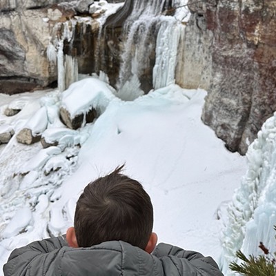
The best part about this run is its proximity to town - which means no, or minimal, driving. The second best part is the epic views of waterfalls and the lush canopy of pine trees that surround you on all sides.
Meadow Camp to Dillon Falls - River Trail
Although this trail is often congested with tourists in the summer months, it is pristine and solitary during the shoulder seasons. I especially love it in the fall, when the aspens on river right change color and glitter like gold and copper coins.
Tumalo Creek Loop - North Fork Trail to Farewell Trail
You might have to work your way up to this one, as it is almost ten-miles of climbing and descending a steep gradient. The rewards are many, however. The North Fork Trail winds along Tumalo Creek with views of cascading waterfalls at every turn. The trail then graduates onto a plateau near Rock Creek that feels paradisiacal with violet wildflowers, plush grassy beds and gin-clear mountain waters gurgling through narrow channels.
Shevlin Park Loop
Another classic with Tumalo Creek as its centerpiece, this is a great training route for those looking to build endurance before a race. There is a lot of elevation gain and loss along the ridges by the river. The only set-back, if it could be called that, are all the inviting little nooks of logs and rocky beaches where I always end up hanging out and listening to the music of the creek instead of finishing my run.